
I recently wrote an article for Realtor Magazine discussing the use of aerial photography for real estate listings. Now that spring is finally here and the snow is melting, I’ll be able to get out and fly around town. I plan on updating previous blog posts with aerial shots of each neighborhood and will be putting together a video. I’ve purchased a backup system that is a little more portable, and am planning on upgrading our main rig to one that can support a larger camera.
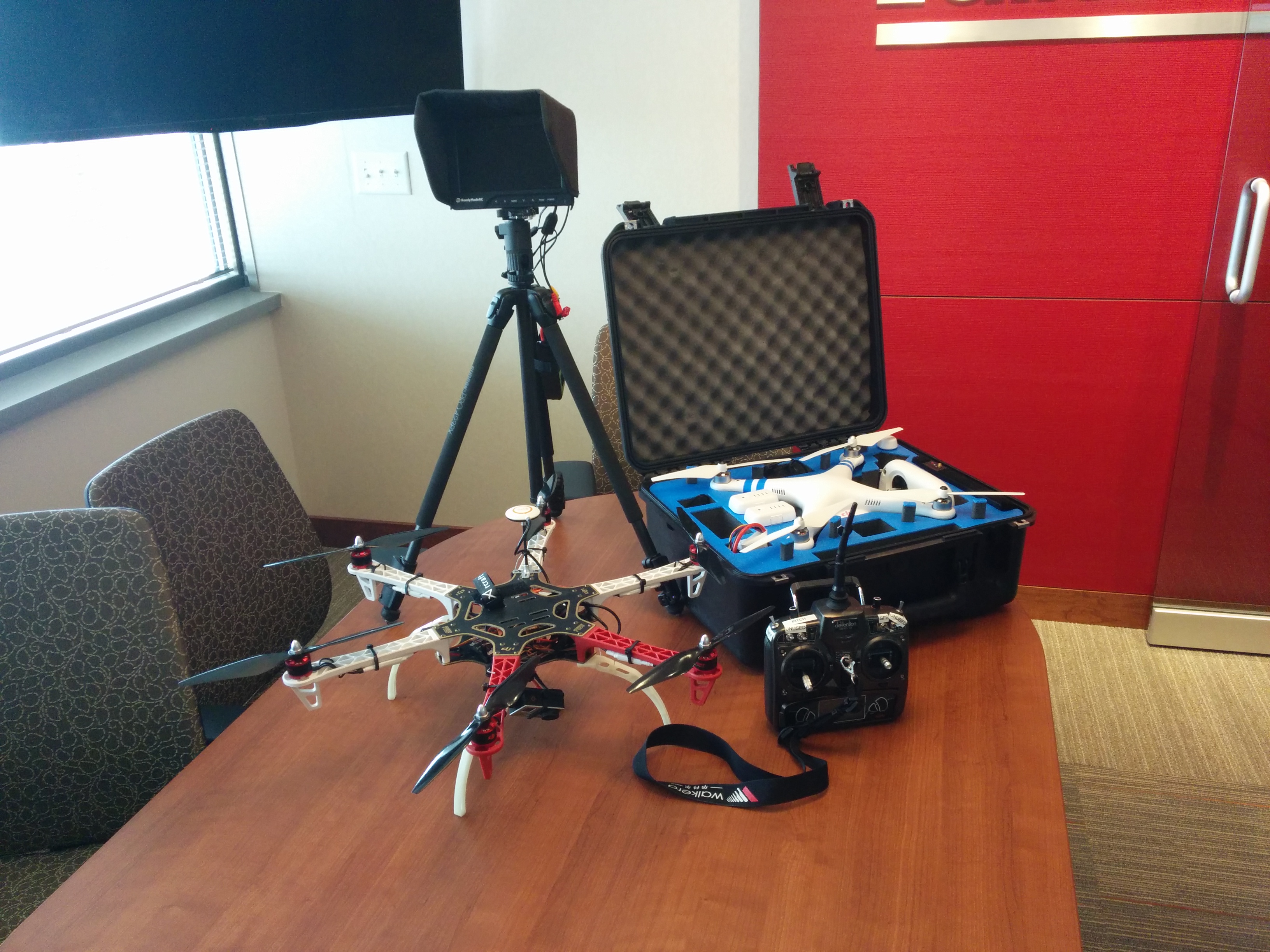
Aerial photography is something exclusive to our team. Since we own the technology, we are able to re-shoot photos and video as needed. These specialized multi-copters with cameras attached enable us to showcase your property in a way it has never been shown before!
Here is the original article that I published;
By Brandon Doyle
The use of aerial photography in real estate is becoming a hot topic. The cost of drone technology is now at a point where it is affordable for some real estate professionals to own multi-copters themselves, and many photography companies are offering this service for a fee to practitioners.
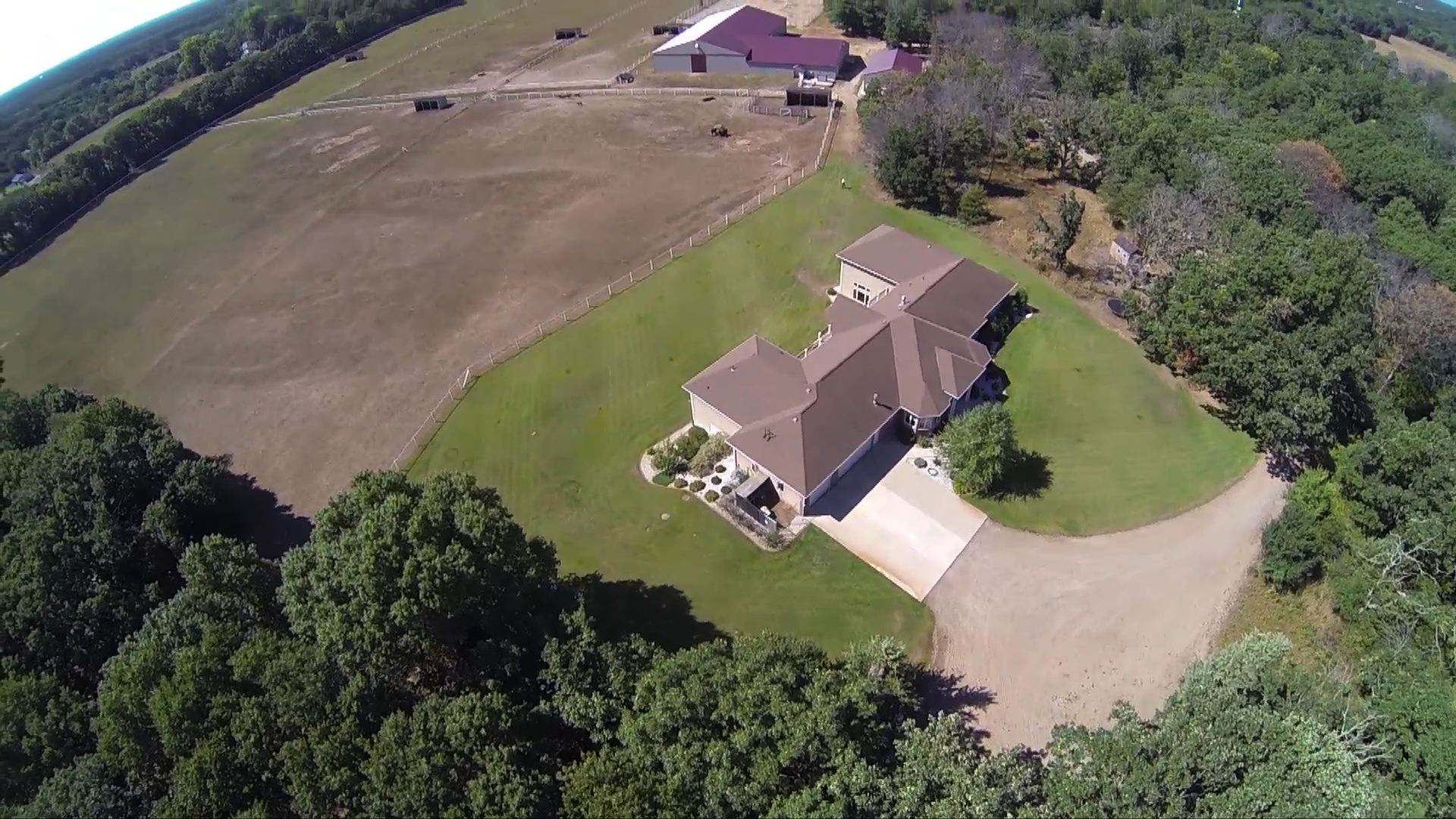
I personally have experience owning and using remote control multi-copters for aerial photography. It has been great for showcasing large acreage, as well as lakefront and agricultural properties online. It allows me to capture a unique view that grabs the buyer’s attention. In today’s world the first showing is online, and it is important to do everything possible to capture the potential buyer’s consideration.
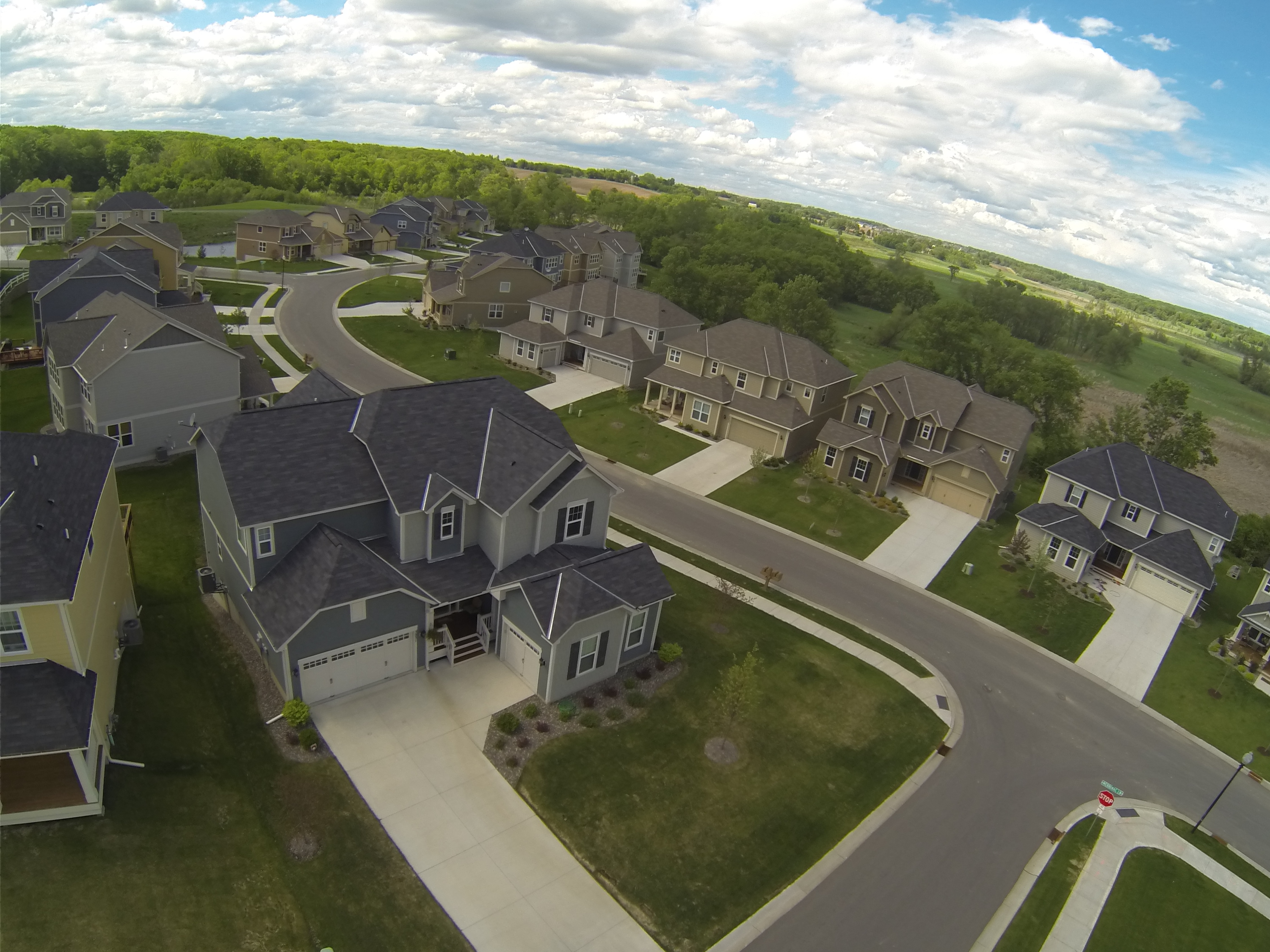
 Aerial photography is a great way to stand out from the competition. It is much easier to visualize 40 acres of land from the air than it is standing on the corner. Homes with acreage or water features benefit greatly from this technology; with a standard photo you wouldn’t know what is behind the house, but with aerial photography buyers can see the lake in the first photo.
I started by researching and testing a quad-copter that a teammate and I purchased online back in the late summer of 2012. We added a camera, gimbal, and video downlink system in order to capture video in real time from the sky. Since then, the cost of equipment has gone down substantially. Now you can buy a ready-to-fly system, with GPS and GoPro camera for under $1,000. While larger, more robust systems start around $2,500 and quickly go up from there. These larger units are capable of lifting DSLR cameras, and have longer flight times.
 The DJI Phantom, is a user friendly and upgradable quad-copter that comes with all of the features you need fly right out of the box. While operating in GPS mode, flying is pretty straightforward. It is upgradeable with a gimbal for stabilization, video downlink system, and can even be controlled via your iPad with programmable waypoints when you purchase a data link.
With this technology, comes responsibility, it is very important to fly in a safe manner and use common sense. When we fly, we stay under 400 feet with permission from the home owner. Never fly over crowds or on-lookers. You want to maintain visual sight of the aircraft, and be in control at all times.
The FAA is slated to create legislation for regulation of UAVs by 2015, yet as of today, they have a long way to go in defining uses and potential regulation. It is likely that small systems such as these will be classified as “sUAS” and have their own set of rules. As of March 6, 2014, a federal judge has ruled that it is legal to fly these aircrafts under 400 feet for commercial purposes, overturning previous FAA regulations that restricted business use.
*Recommendation from NAR: Until the FAA presents its plan to Congress next year addressing the use of drones for commercial purposes, NAR recommends that REALTORS® avoid using drones until the government clarifies the rules.